Featured Map for 15 April 2010:
Eyjafjallajökull Eruption and North Atlantic Flights
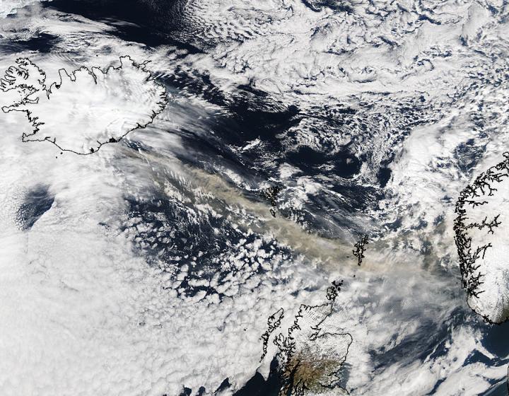
The volcanic eruption under Eyjafjallajökull glacier in southern Iceland early on 15 April 2010 led to the closure of airspace over much of Northern Europe and cancellation of many flights across the North Atlantic. MODIS imagery taken in the afternoon after the eruption began (from NASA/GSFC, MODIS Rapid Response) shows the ash plume traveling east southeast across the Shetland Islands toward the southern tip of Norway:
The following map shows the approximate path of the ash plume overlayed with major cities in the areas most affected and the great circle tracks of several representative trans-Atlantic flights (JFK-LHR and SFO-FRA):
Travelers stranded on one side of the Atlantic or the other are surely frustrated, but wouldn't want to experience a repeat of British Airways Flight 9 or other instances of loss of engines due to ingestion of volcanic ash.
References and additional information:
|
Information on this site may not be accurate or current and is not valid for flight planning or navigation. No warranty of fitness for any purpose is made or implied. Flight planning and navigation should only be done using official charts.
Copyright © 2010-2024
Karl L. Swartz.
All rights reserved.
|

