Featured Maps: Packing A Canon's Recent Trips (20 February 2010)
Packing A Canon is a blog about Brian's travels. Brian has used the Great Circle Mapper for a long time but just discovered the new site and has been having fun using some of the new features in mapping his travels. Here are a few samples from the blog.
The first map shows his last trip, using varying colors and path widths to differentiate each part of the trip. (Click on the map to see how it was generated.)
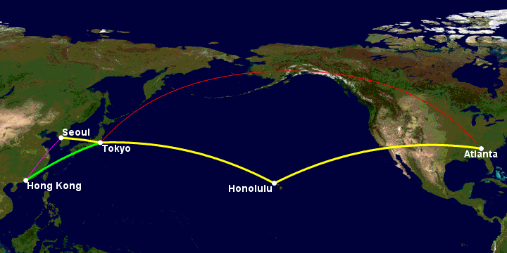
19,080 miles
The next map documents Brian's 2009 travels:
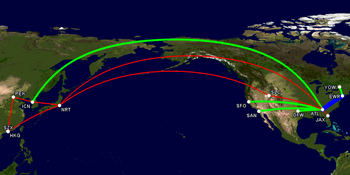
Green = round trip | Red = single leg | Blue = 11 round trips
This map uses colors and path widths to show often Brian flew each path. With the map getting a little crowded he switched from city names to IATA codes and reduced the font size.
More maps, showing past years' travels, can be found on the
Where Have You Been?
page of Packing A Canon.
Maybe they'll inspire you to map out your own travels.
|
Information on this site may not be accurate or current and is not valid for flight planning or navigation. No warranty of fitness for any purpose is made or implied. Flight planning and navigation should only be done using official charts.
Copyright © 2010-2024
Karl L. Swartz.
All rights reserved.
|